

Showing posts with label Colorado. Show all posts
Showing posts with label Colorado. Show all posts

How Is AI Technology Being Used for Wildfire and Arson Detection
In the battle against wildfires and arson, technology has emerged as a formidable ally, aiding in early detection, rapid response, and effective management. This article delves into the innovative technologies that play a pivotal role in detecting wildfires and arson, offering insights into how these tools are transforming the way we safeguard our environment and communities.
East Troublesome Fire & Evacuation Map Near Lake Granby
Grand County, Colorado East Troublesome Fire explodes to 125,677 acres.

These areas are also currently under mandatory evacuation orders:
- All areas west of Highway 34
- All areas north of milepost 2 on Highway 34 to Rocky Mountain National Park
- Trail Creek subdivision - Area I
- Both sides of Hwy 125 from milepost 5 to the Grand/Jackson line
- Sheriff Creek / Kinney Creek area
An evacuation center was set up at the Inn at Silver Creek in Granby. Anyone forced to evacuate was asked to register using East Troublesome Fire Evacuee(s) Registration Form to assist with the re-entry process, the GCSO said. 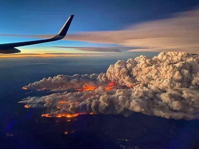


Calwood Fire Map & Evacuation Boulder, Colorado
Both the CalWood and Lefthand Canyon fires increased containment on Wednesday with minimal fire growth. The CalWood Fire is now 24% contained and the Lefthand Canyon Fire is 43% contained. Yesterday, crews on the southeast edge of the CalWood Fire conducted a successful tactical burn operation near the Balarat Education Center to protect structures in that area and connect constructed fire lines. Firefighters continued working in the Highway 7 corridor and along the northern edge of the fire constructing direct line and checking the progress of the fire to the north. Last night’s night shift was successful in holding the fire to minimal growth despite the overnight Red Flag Warning that brought warm temperatures and high winds to the ridgetops.
Firefighters on the CalWood Fire will continue yesterday’s work in all divisions. Crews on the southeastern side of the fire continue to build line as the fire backs down the hill towards Spruce Gulch. On the southwestern side of the fire, crews will patrol the area near yesterday’s firing operation. On the north side of the fire, crews will continue working on the canyon’s edge and in the Highway 7 corridor with the intent of keeping the fire south of Highway 7. Crews on the northeast side of the fire will continue constructing and patrolling fire lines.
Firefighters were able to secure the southern edge of the Lefthand Canyon Fire on Wednesday and no new growth was recorded after midday yesterday. Crews working on the north side of the fire continued mopping up and improving containment lines. Further increases in containment will come as additional containment lines are secured.
Weather & Fuel Conditions: A cold front arrived over the fire area early this morning and will continue moving into the area throughout the day. Temperatures will fall through the afternoon, dropping below freezing after sunset. Humidity will also be increasing over both fires today, rising to 60-70% over the course of the day. The changing weather conditions are also expected to temper fire activity today.
Extremely dangerous #CalwoodFire just north of Boulder, CO directly affecting WUI right now. I have observed multiple large fire vortices and a large, rotating pyrocumulus column. Wow. #COwx pic.twitter.com/BCnUhMIScn
— Daniel Swain (@Weather_West) October 17, 2020

Cameron Peak, Colorado Fire & Evacuation Maps
On August 13, the Cameron Peak fire in the Arapaho and Roosevelt National Forests between Cameron Pass and Chambers Lake erupted. It burns over rough terrain in thick timber stands. Fire development has been propelled by high winds combined with critically dry fuels. There are evacuations and closures in place.

Active Colorado Wildfires Maps
Colorado Current Wildfire Maps

Popular Maps
-
 Canada Wildfires 2026: What Caused the Fires, Where They Are Burning, and the Growing Disaster Threat Map: Natural Resources Canada’s Canad...
-
Security fencing can seem like a fairly straightforward decision until you start looking at the site properly. A fence around a warehouse y...
-
Planning for tomorrow’s weather is more than convenience — it impacts agriculture, shipping, aviation, and even local events. But not all w...
-
In Florida, mandatory evacuations are issued when a serious threat to life and property is imminent, typically due to natural disasters like...
-
 Flash floods are one of the most dangerous weather events, often occurring with little warning and resulting in severe damage. Flash flood...
-
 How To Subscribe Visit the DisasterReliefMaps.com website. Sign in using your Google account to instantly access our extensive disaster...
-
 Are Natural Disasters Increasing? What 10 Years of Hurricanes, Tornadoes, Floods and Wildfires Tell Us Natural disasters can make almost any...
-
 Public Perception Maps vs Actual Lava Flow on Hawaii Big Island Hawaii VOG Map If you are planning to vacation or li...
-
 Florida, known for its sunny beaches and warm climate, is also one of the most hurricane-prone states in the U.S. Understanding Florida'...


